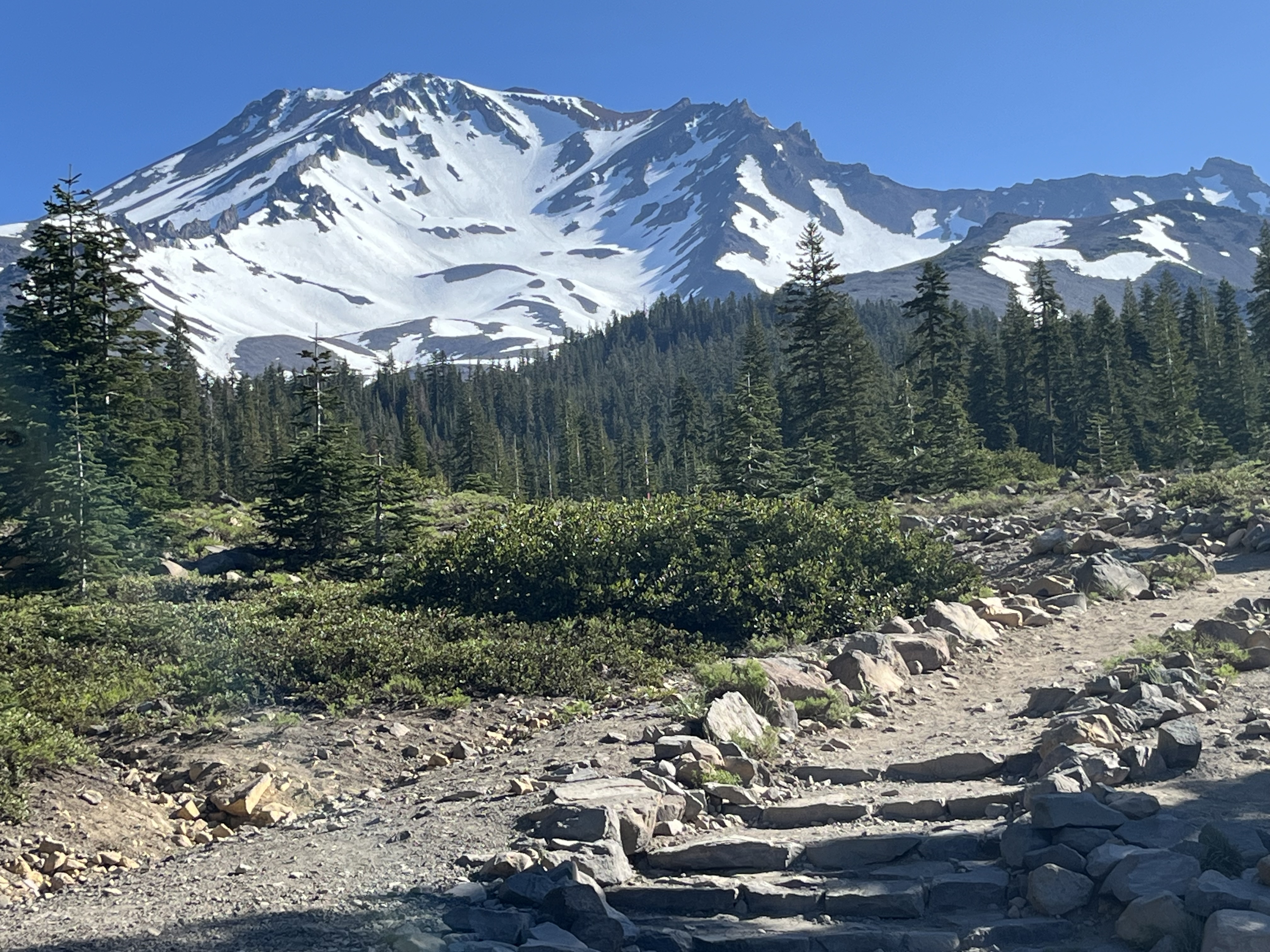
Mount Shasta and Crater Lake
In which Moominmama hikes the PCT (3 miles of it) and views (for now) dormant volcanos...
Mount Shasta, pictured above, dominates the skyline in northern California. Apparently, it can be seen as far as Redding to the south, and Moominmama saw it faintly on the horizon from Crater Lake to the north.
Driving in California, the mountain has a way of popping up over the pines as you turn a corner, and in many spots, it towers over the landscape like here at Siskiyou Lake beach.
At 14,179 feet, it has a lot of presence! Unlike the granite peaks of Castle Crags or the sedimentary rock of the nearby Klamath Mountains this is a dormant stratovolcano.
One of Moominmama's favorite hikes this week was along the southeastern flank of Mount Shasta, a hike that took her up to tree line, where the volcanic rock is still plainly visible despite the snow. The most recent confirmed eruption dates back 3,500 years, but Shasta is part of the so-called "Ring of Fire" that follows the edge of the tectonic plates in the Pacific Ocean where volcanic activity and earthquakes are still common.
Moominmama's second favorite hike was one that went from Castle Crags campground to the Pacific Crest Trail, allowing her to hike about three miles of the PCT before looping back down.
It was great fun to think about the people whose footsteps passed this way before, people like Cheryl Strayed, who wrote the book "Wild: From Lost to Found on the Pacific Crest Trail." The park where I was staying is near a PCT resupply location, namely a post office and shop just outside the campground. I expected to see more through-hikers, but with snow still at higher elevations, perhaps they come later.
Moominmama had high hopes for Castle Crags, advertised by a friend as a small Yosemite. Um, not quite. Work along part of the trail into the granite peaks was closed, forcing hikers to start the climb at much lower elevation. It's been hot and dry out, and Moominmama lacked the oomph to try an almost 3,000-foot climb.
Instead, Moominmama aimed for a waterfall hike in nearby McCloud, easier and much nicer for a hot day!
After a short stay in northern California, Moominmama drove north across the border into Oregon. I'm staying near Medford, on the Rogue River. This river starts up in the snow-covered Cascades and probably includes some water that escapes Crater Lake.
Moominmama spent a day up at Crater Lake National Park, looking at its cool blue water from the rim road. The lake is misnamed since it's not the result of a meteor strike. This impressive, and very deep, blue bowl, was the result of volcanic action. It was once a mountain (now referred to as Mazama) that erupted so violently, it left a dark pit that is now the deepest lake in the United States:1,943 feet at its deepest point.
The caldera, which has steep sides that continue to slide into the water, is another dormant volcano. A submersible rover found several vents under the lake still releasing small amounts of gas in 1987. Wizard Island is a mini volcano cone that sticks up out of the lake, and all of this suggests the underlying volcano could bubble up again.
Unfortunately, the park is due for some major repairs, and the sole trail down to the water's edge is closed, which was a major disappointment. Moominmama longed to feel the chill of that striking blue on her skin. But there will be no water access for a couple years now.
One of the challenges is the immense amount of snow that Crater Lake receives. The rim is between 7,000 and 8,000 feet in elevation and gets an average of more than 40 feet of snow each year. For the plants, this translates to a three-month growing season. But it also leaves only about three months a year for repair work.
There was still plenty of snow at the end of June, and the official tourist season for Crater Lake doesn't start until July. But Moominmama took a picture of this little bouquet of flowers blooming right out of the gravel roadside near the Watchman viewpoint. Life is so darned determined!
Crater Lake has no inflow so depends almost entirely on snowmelt and is some of the purest water in the world, absolutely safe to drink for those who can get to water level. While the water is mostly contained in the lake, it does appear to have a natural overflow valve like a bathtub. It maintains a very consistent water level.
It does that by releasing water through underground channels that feed area streams and the likely the Rogue River, which predates the lake. In fact, part of the Rogue River carved its way through the magma and pumice expelled when Mazama erupted, creating this beautiful gorge on the road below Crater Lake. This water makes its way all the way to my campground 60 miles away and ultimately flows out to the Pacific Ocean. This, in the end, may be the only way I get to put my hands into the blue water of Crater Lake, a few molecules in the larger flow of the Rogue.


Thank you for another comprehensive and informative narration of northern California’s high points. But Is Weed, CA on your itinerary?
ReplyDeleteI did stop in Weed! But only for gasoline.
DeleteGlad you got to experience Mt Shasta. Mud pots at Lassen next time!
ReplyDeleteDefinitely!
Delete